
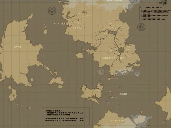
The Northern continent is where most of the games have taken place and is home to the Toran Republic, Dunan Republic, the Grasslands, Zexen Confederacy, Holy Kingdom of Harmonia, the Nameless Lands just to name a few. The island off the South-East coast of the Toran region is Kanakan.
Note that the continent Falena itself is on isn't shown much but the top of it can be seen to the south, though the full scale of the Southern continent isn't known aside from what can be deduced by combining this map with a map of Falena, the exact size and location of nations like Nagarea and New Armes are also unknown.
The largish landmass in the middle of the ocean seperating the North and South continents, known as the Kuknasi Sea, is the Dukedom of Gaien with the Island Nations Federation to the East but barely visible at this scale.
You can also see most of the Western continent, though no game has taken place there it is known to be the home to the Kingdom of Zelant.
You can also see a small section an Eastern continent of which there is little information.


